
The Issue:
1. Maps lack our BGTSCC specific locations.
2. The commonly used 3e map might actually be the worst available official map ever made. It is inaccurate in both location placements (The Twin Towers in Amn are NOT behind the cloud peaks that border our region. They are behind the small teeth mountains) and even geographical features (The hill of swords is located above the battle of bones and the northern part of the reaching woods is missing) while also having the general scale COMPLETELY off in different ratios (vertically and horizontally). It doesn't even properly convey the scale of the world.
The solution:
I've taken the cursed edition 4e map as a base, because this is funnily enough the most perfect and accurate geographical map to 1e and 2e out there. Likely using them as a layer in their program. Granted the locations are all over the place. And used sources from 1e, 2e supplements and other maps to accurately place locations in the map.
In addition I've uncovered the FR Interactive Atlas which helped me get a lot more locations that would realistically be present in our time frame as its a 2e map, its bigger issue is missing places (Its a 2e map, no Greenest etc).
What I need:
Help and feedback. Please help me with fact checking the map and making sure that every location makes sense. Ive gone through sources and tried to place things which make as much sense possible. But I'll also need help with any BGTSCC locations. As well as any aesthetic choices Ive taken on such as coloured font for certain kinds of things (Im thinking of going green for forests so the text is more readable).
Thank you! All feedback is appreciated.
Links
Links
Assets for wonderdraft they contain instructions.
The Wonderdraft map file download this to edit the map itself!
PNG map files of the layers
Version 6:

Embedded for zoom: https://drive.google.com/file/d/1cJQMeR ... bbSMt/view
Edit:
Map has been updated with changes to V2
Changelog:
Hidden: show

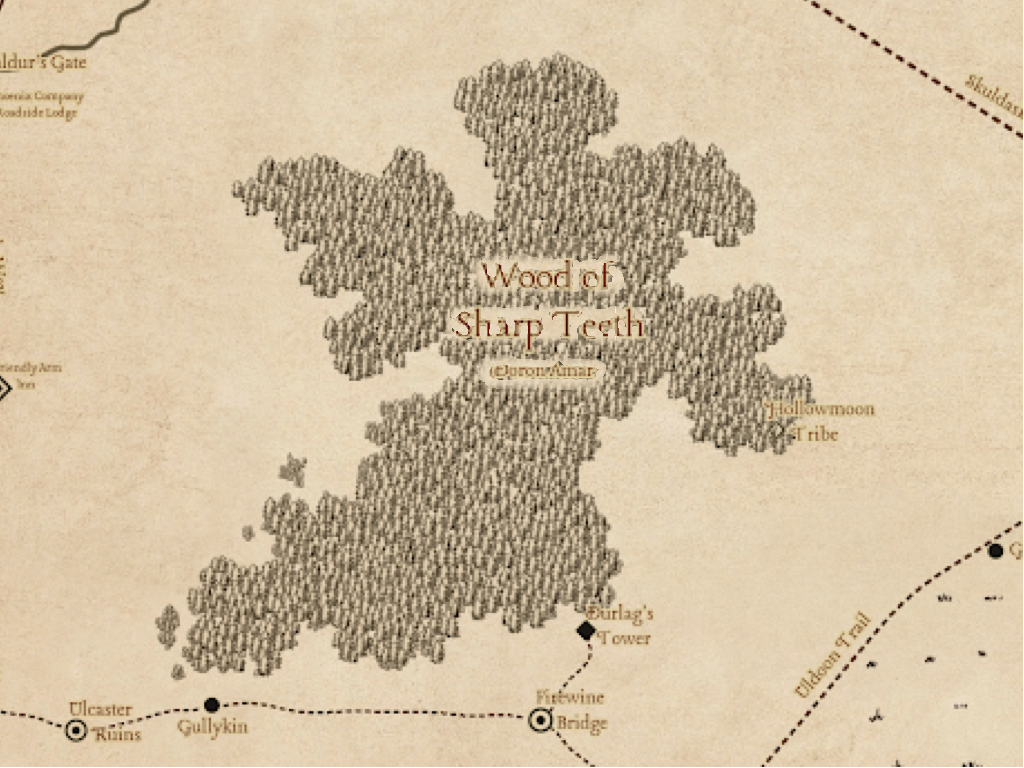
I called the unnamed trail to Ulgoths Beard, Ulgoths Trail. It would most likely have been called the trail to Ulgoths beard, then Ulgoths Beard Trail, then Ulgoths Trail as time passes. Maybe not officially but highly likely.
The trail through eastern Green Fields is unnamed. Meaning it's not major enough. Still, I want to have names for all the roads possible. Green Trail seems like the most likely. Since people using it would probably call it the green fields trail, then naturally shorten it to Green Trail. I left it ??? For now. There is far too little to go off here and I dont want to make such decisions.


